
Geospatial Information Science student from the School of Planning and Architecture emerges top in a global GIS competition
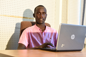
Mr. Dennis Kimeli of the School of Planning and Architecture recently participated in the inaugural Mapping Horizons GIS Competition and emerged the best in East and Southern Africa. He demonstrated his ability to use GIS and Remote Sensing to analyse deforestation and land-cover dynamics in Nandi South Forest to understand their impacts on climate change in the area. The competition was organised by the International Association of Young Geographers (https://iaygfamily.org/). In their assessment of Mr. Kimeli’s submission, the competition judges noted that he demonstrated “creativity and elegant presentation of data in the project” and hoped that their recognition his of work would offer him a wonderful encouragement for his future GIS journey. He got a Certificate of Participation and a cash prize.
The International Association of Young Geographers (IAYG) Mapping Horizons is a Non-Governmental Organization, whose aim is to empower and educate the youth on the importance of conserving the natural environment for posterity. It organises yearly GIS Mapping competitions whereby students from all over the world submit their projects based on highlighted topics. The call for the year 2020 focused on six topics, namely: i) COVID-19 and its impact on the society, ii) Public health and access to medical care, iii) Economic inequality and development (including education), iv) Climate change and natural disasters, v) Urban growth and development, and vi) Security and community safety.
Mr. Kimeli says that he was motivated to participate in the competition by his desire to explore the applicability of the skills he has acquired from his training in Geospatial Information Science to solve real world problems in general and climate change in. Through his project, he hoped that he could share ideas that would help the organisers of the competition to educate majority of the youth on matters of conservation and natural resource management. According to Mr. Kimeli, the knowledge he gained from his lectures on image processing, change detection, spatial and non-spatial data analysis, modelling, and remote sensing, proficient data management and cartographic skills and techniques were useful in the project. He says that through the case study assignments that are given as part of their training, he has learnt to pay attention to details and to do personal quality control for drafts and deliverables. He is grateful to the entire School of Planning and Architecture for the training and support he has received thus far, and which have enabled him to have a clear grasp of the skills that were useful in delivering his project.
Writing the project was not without its challenges though. Mr. Kimeli says that some of the challenges encountered included difficulty in acquiring high resolution and cloud free satellite imagery, which is the most determining factor in the accuracy of the land cover change dynamics. Inadequate funds for ground truthing purposes was also another major challenge.
His advice to other students of Geospatial Information Science at Maseno University is that they should never underestimate the abilities and skills that they have acquired while pursuing their coursework. For him, he could not imagine that his project would emerge the best in the entire East and Southern Africa and among the best in the entire world. He says that the confidence in the skills gained from the university and during his industrial attachment period have been instrumental in shaping his outlook to life. He would also want to encourage the students to participate in GIS and related events like the GIS day presentations and other online events so as to gain confidence and showcase their ideas in solving real world problems.
According to Dr. Moses Kola, the Dean of The School of Planning and Architecture, Mr. Kimeli is an excellent demonstration of the commitment of the School to train graduates with the right skills to make significant contribution to sustainable development. He says that their programs are carefully designed to respond to the contemporary and future challenges that face human settlements.
More on the project can be found in https://storymaps.arcgis.com/stories/6b234c1b01164160a0db00b373b10235